SUMMARY: A little Calero Creek Trail hike.
This coming Sunday, our Bay Area Ridge Trail group will be hiking Santa Teresa Park. The only part of the planned hike that I haven't been on is actually outside the park, flat along Calero Creek. (Yes, there are places where you have to come down off one ridge to get to the next one. This is one such place.)And the trail map notes that there is a "seasonal creek crossing." And a couple of photos that I found on the web seemed to show substantial water. I wanted to check it out before we all go there Sunday.
So on Friday morning the Merle Girls and I drove all the way to the park, hiked 1.2 miles along the trail, and then 1.2 back. Not a strenuous hike. Beautiful day, quiet trail, saw only two joggers, one biker, and one horse the whole 50 minutes.
Much of the trail led between an orchard and the creek. The first part of the trail, closest to the road, had a pretty fence separating it from the orchard. (Too much underbrush separated us from the creek to ever get a good view of it.)
That shortly became barbed-wire fence, but it is well-tended, taut wire fencing as the trail strolls amiably among tall, shady trees.
But--huh--wonder what goes under here so often as to have pushed the wire up and worn a path? Going from the orchard to the creek? Or vice-versa?
The hills of Santa Teresa Park rise behind the orchard.
Looking back whence we came. It's a gorgeous January day, temps in the mid-60s (mid-15s C).
I liked the lichen growing on the trees; you'd never notice it during the times of the year when the trees are fully leafed out.
Oh, and look at these cute dogs I found lying next to the path!
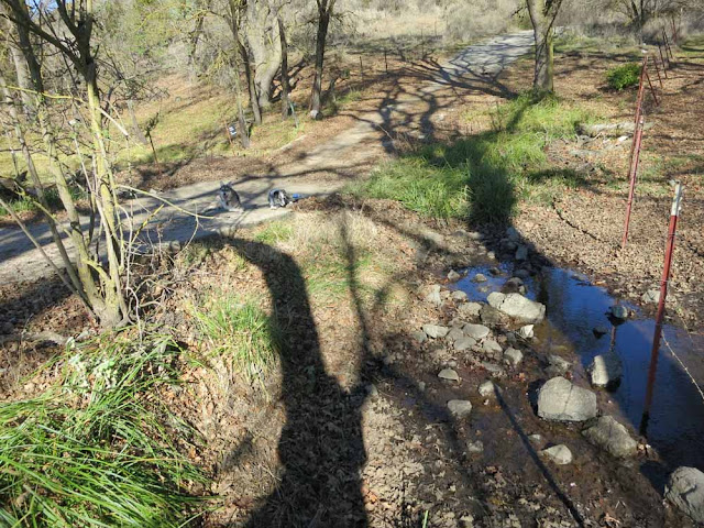
And, well, here we are at that seasonal crossing. The trail here is briefly concrete, which dips into the creekbed but not all the way down. With not much rain and a very small creek, the water just stops here next to the roadbed. There would have to be a lot of water for it to be high enough to go over the road--I don't think we'd want to wade through that! So this week, at least, we will stay high and dry if we get this far on the hike (coming from the other direction). But we can admire the twisty turny shade of that tall tree.
Mission accomplished (after a bit more hiking), we returned to MUTT MVR and headed home for some cool drinks and a rest.


What a great hike! I hope you have a great time tomorrow!!! Those pretty dogs you had by the side of the road look a little perturbed to have to wait for you!
ReplyDeleteDon't they, though? We might not get to this section--first half is 7 miles and 1400 feet up & down. But at least now I've done it. :-)
ReplyDeleteSO how did it go today?
ReplyDeleteGreat! Will post later.
ReplyDelete