SUMMARY: An event and a hike.
One doesn't get to do this every day. But we did on Saturday: Attend the ribbon cutting for a brand-new trail, then hike it. Here we are, looking out over the Santa Clara (aka Silicon) Valley, with the trailhead of the new trail beyond us. (The first three of us are agility friends and the others are, like, normal friends.)
This is part 3 of our goal to hike the entire Bay Area Ridge Trail. Not all of which exists yet, so this is a new 6-mile segment.
It has some gorgeous views of the mountains and of the valley--well, OK, the valley would be nicer if it weren't for the inversion layer trapping all those particles in the air.

A bunch of people spoke at the opening ceremony, people from the Santa Clara County Open Space District, the Bay Area Ridge Trail group, the coastal preservation group, groups like that, who work together to make things like this happen. And the usual politicians. Even a meteorologist. Here's San Jose mayor Chuck Reed--

--and the president of the Silicon Valley Leadership group (made up of CEOs of over 300 local companies, and which has been promoting open space), who rode up the 3-mile, 2000-plus elevation gain road on his bike for the event. Just behind him, you can barely see the domes of the Mount Hamilton observatory on the highest peak.

Here's a map of the area in which we hiked (click map,then click Show Original to see larger version):
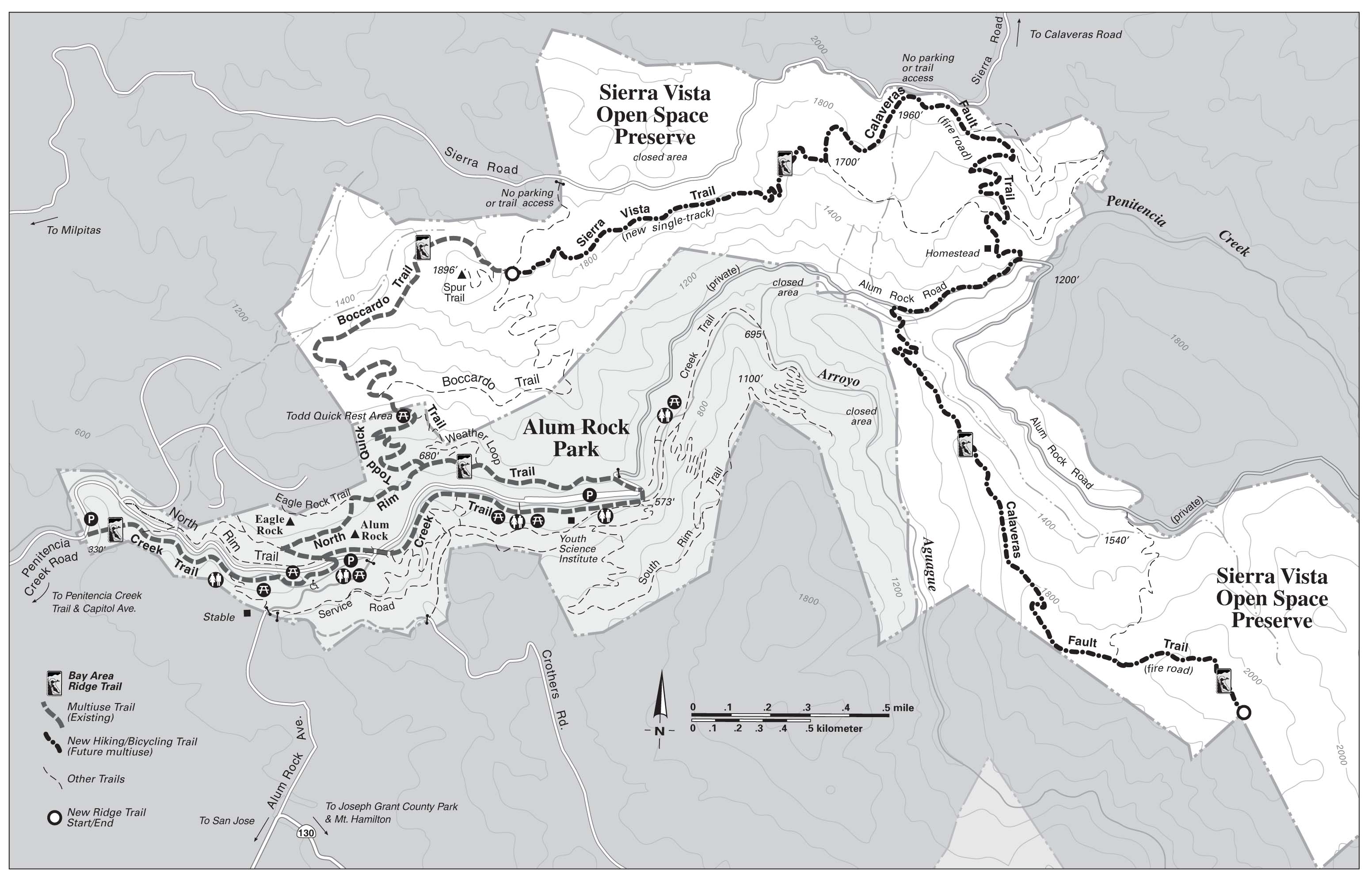
For you trail-following fans out there, our route was:
- Get off the shuttle bus on Siera Road where it comes into the Preserve from the left (says "no parking").
- After the ceremonies, walk down the dotted line to the Sierra Vista Trail.
- Go east, following the heavy dotted line up and over the Calaveras Fault trail, down to the old homestead.

- Back across the pale dotted line that cuts west back to the Sierra Vista Trail.
- Retrace our Sierra Vista steps .
- Down the Baccardo loop trail (this is half of my hike from last weekend, from here on down).
- To the North Rim Trail in Alum Rock Park, east to its end (still on the dark dotted line).
I'm deeply grateful to the ranchers and landowners who have donated or been willing to sell their properties or have given easements for trails across their properties. These are treasures beyond reckoning, saved for us and for future generations.
If you want more photos--views, trails, cool-looking ancient cattle breed, old barn, bees in a tree and in boxes, an old treehouse, even a coyote--they're all here.
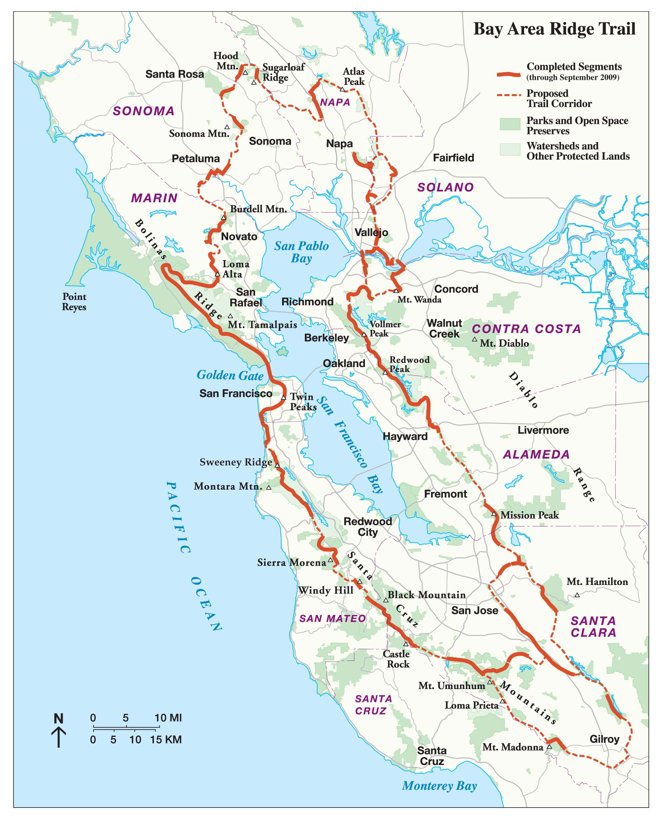
FYI, here's the whole Ridge Trail. About 330 miles exist now (solid red); about 550 are planned. (Click map,then click Show Original to see larger version)--also go to http://www.ridgetrail.org for lots more info.)
The part we did is a very tiny piece of the part in the very tiny green bit about halfway between Mission Peak and Mt. Hamilton--we covered about 5 miles of the Ridge Trail (but an 8.5 mile hike over all). So, in 4 months, we've done about 15 miles of it. Maybe by the time we've gotten around to doing the parts that do exist, the rest will have come into being.
My favorites: #1 for the symmetry. # 25, # 34, #55, # 62 and #84...just cause I like them!!
ReplyDelete#62 is the cow mom licking her calf's face? It really needs an "Awwwww, MOOOOmmmm" caption, because he really did act like some kindergartener getting his face wiped off.
ReplyDeleteThat is so cool... And inversion layer or not, I looooooove your views. That old homestead is so neat -- love stuff like that. Man, the trails around my place so suck compared to yours and a certain Boulderite's! :-P
ReplyDelete