SUMMARY: On to Glacier Point!
In theory (there's a lot of that going on here) I'll be on the road when this is posted. Planning on leaving home about 5:45 a.m.
Dogs are staying home; too bad for them, but can't take them on this trail.
Temps are supposed to be in upper 80s in the valley! Maybe mid-60s atop Glacier Point, or maybe not. Plus the chance of scattered thundershowers. Not sure I really want to be going across the face of a cliff in a thunderstorm. We'll have to keep our eyes open at all times. (Actually I was planning on doing that anyway.)
I have my rental camera in hand with a spare battery and 8GB of memory. If only there were actually water in the waterfalls! Can't have everything. Here are all the SLR (single-lens reflex) cameras that I have in my house right at the moment. You'd think that I wouldn't be having any camera issues!
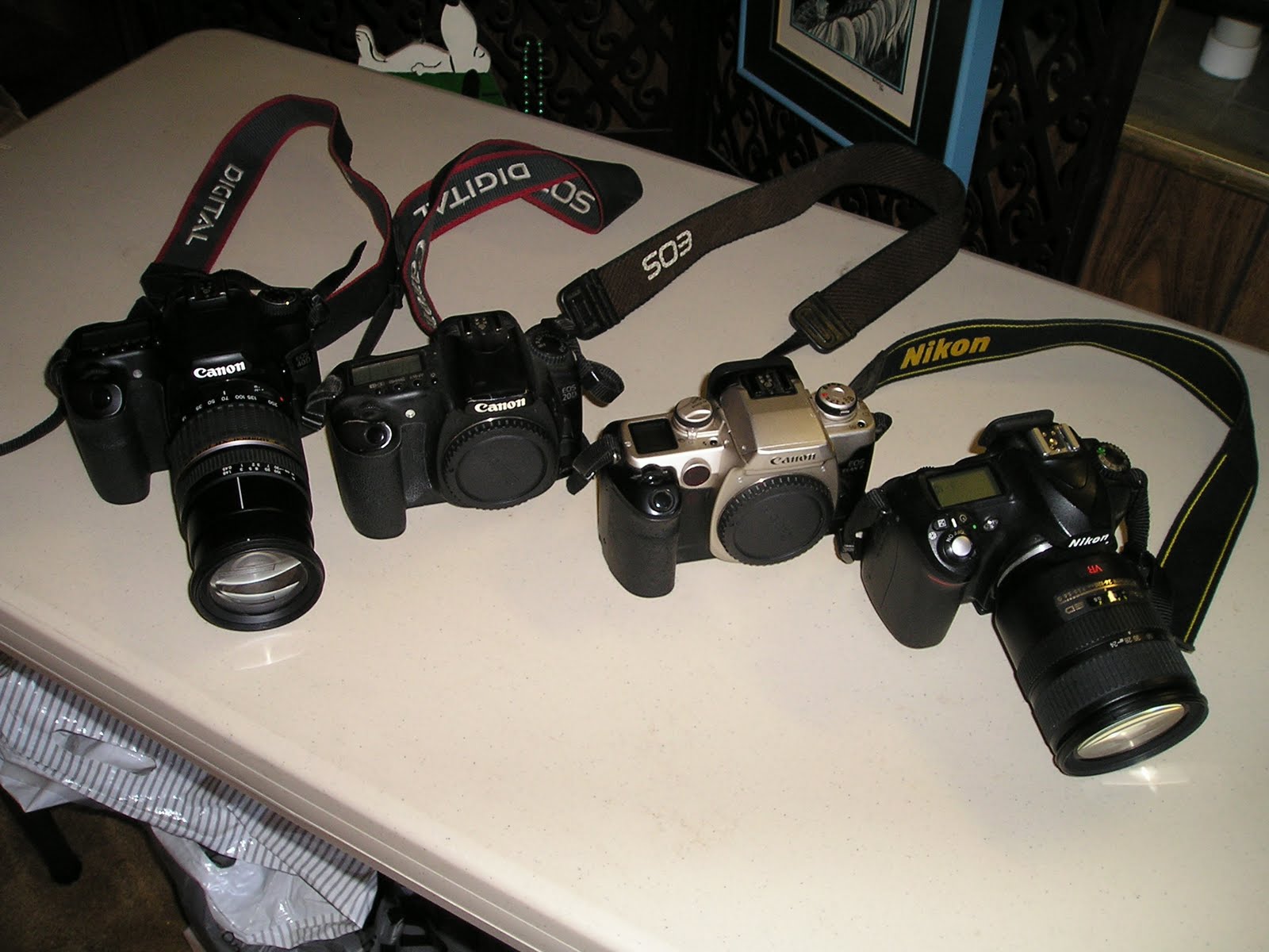
Borrowed Nikon works fine except that I've used up both batteries, don't have a charger, and have to return it next week. Three Canons but only one lens that fits any of them (and it's borrowed). One is film. One is borrowed and came with no battery or card. One of them is rented for the weekend, along with 2 batteries, card, and charger. So, really, I have one functional Canon at any time. Funny, huh?
Oh, yeah, what did she take the photo with? That danged point-and-shoot.
Found this site that has cool charts that graph your elevation based on how far you've hiked, your elevation based on how long you've hiked, and your miles traveled over time. We statistics wonks love this stuff. Look here!
That site claims it takes 5 hours round trip. I have my doubts. I'm guessing 6, with a an additional rest period at the top for lunch, ice cream, photo taking, and other touristy stuff.
Here's a similar map, showing that all 5 miles of Four-Mile Trail go pretty much up up up; no level parts or dips. (Elevation in feet on the left; miles traveled on the bottom.) And, for your comparison convenience in how high we're climbing, I've slapped on outlines of the world's tallest buildings (Empire State Building on the right) with their bases at our starting elevation, 4,000 feet. We'll be going up about 3,200 feet (975 m) according to plan. That's like climbing to the top floor of the Empire State Building almost 3 times. Something I would never do in my wildest dreams. Actually hiking the trail will be much easier than climbing stairs would be.

And here's a cool tracing of the trail showing the terrain and topography. I recommend clicking the "Terrain" button at the top of the map for the most useful view.
Meanwhile, you can:
* Find out about current Yosemite conditions.
* See how many bear break-ins into cars in parking lots there have been in the last week.
* Check out weather conditions in the valley with the live Yosemite webcams (Ahwahnee Meadows is in the valley looking towards Half Dome; View from Turtleback Dome looks over the valley towards Half Dome. Glacier Point is offcamera to the right in both those views.)
Graph I used is from http://www.mtbguru.com/trip/show_static/7957-yosemite-valley-to-happy-isles-via-glacier-point-and-panorama-trail; diagram of buildings is from http://commons.wikimedia.org/wiki/File:Skyscrapercompare.svg
I hope you had a mountain of fun!
ReplyDeleteLet me know if you need to borrow a Nikon battery charger. Both my batteries are fully charged.
That looks sooooo friggin cool. Looking forward to your photos and writeup. Hope you had a great time!
ReplyDelete